
Hiking in Mexico: Top 10 Mountains in Mexico Guide
Are you an extreme adventurer looking for mountains in Mexico to climb?
Do you want to know the elevation, location, and some other facts about the mountains in Mexico?
Do you still have doubts about which one is be the best hiking option for you?
Let's climb together to this next adventure, keep reading this article and turn into an expert about mountains in Mexico!
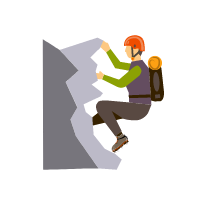
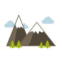

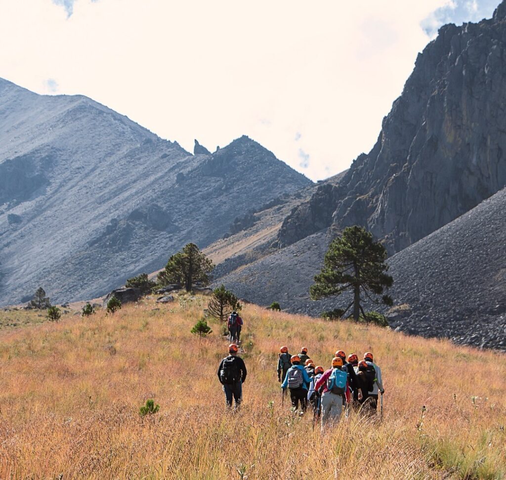
Hiking in Mexico
As we have mentioned before, hiking in Mexico is an experience that goes far beyond something beautiful. You can feel the adrenaline while watching the incredible landscapes that Mexico offers to the world. In most cases, being an expert takes a lot of time and passion for hiking. Therefore, if you are willing to become a hiking expert, Mexico will make you the expert you dreamed of.
There are a thousand hiking options in the world. Nevertheless, the mountains of Mexico have an unparalleled megadiversity. In addition, they are surrounded by fabulous mysticism, which can be seen in the legends surrounding them. Their views, energy, history, and difficulty make every extreme adventurer fall in love with them like never before. Finally, we share the top 10 mountains in Mexico. Hiking in Mexico will make you the wildest explorer ever!
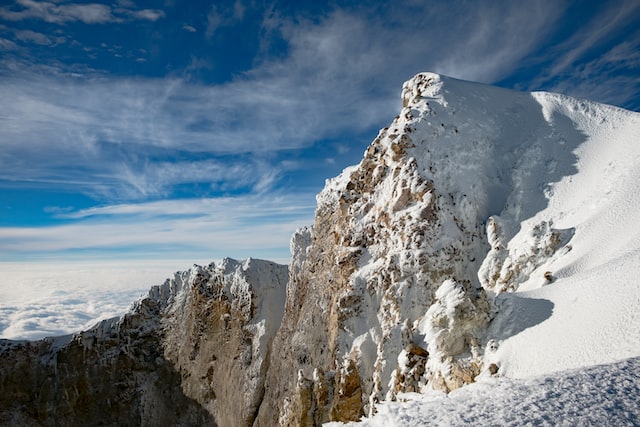
1. Pico de Orizaba
Citlaltépetl, better known as ‘Pico de Orizaba,’ can be considered the best for hiking since it is the highest volcano in Mexico. It is approximately 18,490 feet (5,636 meters) above sea level.
In fact, it is conical in shape, so it has important slopes and special climates as you move along. Truly, experts recommend exploring other hikes in Mexico before trying this one. Above all, this is to test your altitude capacity and practice using special equipment. Hiking in Mexico is a whole new level of experience in this place! Surely, this destination, located right between Veracruz and Puebla, contains many of the greatest beauty, diversity, and microclimates in the northern hemisphere.
Important data:
- Elevation: 18,490 ft
- Prominence: 16,148 ft
- 1st Ascent: 1848
- Location: Veracruz, Mexico
- Mountain range: Trans-Mexican Volcanic Belt
- 1st: William F. Raynolds, F. Maynard
⛰️ Do you want to explore Veracruz and its marvelous natural wonders? Then join us on our tours:
- Veracruz Cities: Tour Ancient Ruins, Majestic Sea and Watch Papantla Flyers (4 Days)
- Veracruz Tour: Travel Mountains, Enchanting Cascades, and Know the Coast Culture (15 Days)

2. Iztaccihuatl
This one resembles the shape of a woman lying on its slopes. In fact, it is located between Mexico City and Puebla, in what is called the Izta-Popo National Park. Indeed, this place is very recognized by locals and foreigners who love hiking since it is the third-highest mountain in the country.
Furthermore, as you explore here, you can find different landscapes, from sand and stone streams to very exposed rocky areas and glaciers. This hike usually takes between 7 and 8 hours to climb.
Therefore, mountaineers usually leave at dawn, around 2:00 or 3:00 am. If you want to go for a fantastic hike in Mexico, you should consider this one! In addition, reaching the top after sunrise is also an amazing experience, according to most climbers.

Important data:
- Elevation: 17,158 ft
- Prominence: 5,118 ft
- 1st Ascent: 1889
- Location: Mexico and Puebla, Mexico
- 1st ascender: James de Salis
- Mountain range: Trans-Mexican Volcanic Belt
🌲 Climb the Iztaccihuatl by joining our tours:
- Iztaccihuatl Hiking Tour: Touch the Sky and Delight in Volcano Town (12h)
- Mexico City Hiking Tour: Trek Glorious Volcanoes (Private / 3D)

3. Popocatepetl
Popocatepetl is a stratovolcano. In other words, it is a volcano that is formed by several layers of solidified lava and volcanic ash. Certainly, this kind of volcano is characterized by producing periodic volcanic explosions. Studies have shown that the age of the volcano is around 730,000 years.
In fact, one of the best places to observe the volcano is the ‘Paso de Cortés.’ It is a mountainous port at 3,600 meters above sea level that crosses between the so-called feet of Iztaccihuatl and Popocatepetl, located in the municipality of Amecameca. Curiously, this area got its name from the conqueror Hernan Cortes, who, according to history, crossed that way when he reached Tenochtitlan.

Important data:
- Elevation: 17,802 ft
- Prominence: 9,908 ft
- 1st Ascent: 1519
- Location: Mexico-Puebla-Morelos, Mexico
- 1st ascender: Diego de Ordaz
- Parent range: Trans-Mexican Volcanic Belt

4. Nevado de Toluca
Truly, Mexico has many volcanos (both active and extinct) that are perfectly safe to go hiking. One of them, Nevado de Toluca, is located in the State of Mexico, just a 50-mile drive from Mexico City. The trails are diverse, and you can easily find one that suits your skills. The weather can get chilly there so you better bring some warm clothes. Furthermore, in the volcano’s crater, you will find the Lakes of the Sun and Moon.

Important data:
- Elevation: 15,354 ft
- Prominence: 7250 ft
- Mountain range: Trans-Mexican Volcanic Belt
- Location: Texcaltitlán, México, Mexico
- Parent peak: Popocatepetl
❄️ Check out our Nevado de Toluca Tours:
- Nevado de Toluca Tour: Hike to the Peak and Visit Charming Town (12h)
- Mexico City Outskirts: Tour a Magic Town, Snowy Volcano, and Towns (10 Days)

5. El Ajusco
This one is ideal for beginners who want to start hiking mid-mountains. Also known as Pico de Aguila, it is located in the Cumbres de Ajusco National Park. Besides, you can jump down the largest zip line in the city. This is the second-highest point in Mexico City, just right after Cruz del Marques, which is around 40 minutes away.

Important data:
- Elevation: 12,893 ft
- Prominence: 3,992 ft
- Mountain range: Sierra de Ajusco-Chichinauhtzin
🌳Explore the stunning Ajusco with us on our Mexico City Hike: Conquer the Ajusco National Park with a Personal Guide (12h)

6. La Malinche (Matlalcueitl)
The Malinche is one of the oldest mountains in Mexico, it has 14,639 ft of altitude. Besides, it is part of the transverse neo-volcanic axis and is very important for the water supply. By the way, the states of Tlaxcala and Puebla obtain water from the water tables of the region. Its most representative vegetation includes high mountain forests, oak, fir, and grasslands. Furthermore, it is located in a National park where you can find cabins, recreational facilities, and a camping area.

Important data:
- Elevation: 14,639 ft
- Prominence: 6,233 ft
- Location: Tlaxcala / Puebla, Mexico
- Route: hiking trail
- Volcanic arc/belt: Trans-Mexican Volcanic Belt
🏞️Experience an incredible adventure in La Malinche with our tours:
- Puebla tour: Explore Ancient Ruins, Nature, and a Majestic Volcano (5 Days)
- La Malinche Volcano: Hike to the Top and Explore Charming Tlaxcala (14h)

7. Cofre de Perote
Cofre de Perote or Nauhcampatepetl is located in the meeting area of the Neovolcanic Axis. To be more explicit, it is at the southern end of the Eastern Mother Range (in Spanish, Sierra Madre Oriental). With 4,282 meters above sea level, it is the number eight of the highest mountains in Mexico. Cofre of Perote is one of the few mountains in Mexico where you can get there by car.
Decreed on Cofre de Perote National Park (PNCP) and Protected Natural Area. It is protected by the National Commission of Protected Natural Areas (CONANP). Surely, winter is the best season to hike around. The activities you can do there include mountain biking, walks, hiking, camping, motocross, and enduro.

Important data:
- Elevation: 14,704 ft
- Prominence: 4,330 ft
- Mountain range: Trans-Mexican Volcanic Belt

8. Sierra Negra
The Sierra Negra is an extinct volcano located in Puebla, just seven kilometers from Pico de Orizaba. It is distinguished by its two pronounced hollows or eroded craters. The first one looks to the south, precisely towards the town of Atzitzintla. The second directs the view to the west, aligned with Ciudad Serdan.
Sierra Negra has a height of 15,026 feet above sea level, placing it as the fifth-highest peak in Mexico. Unfortunately, it is located in the shadow of the even higher and is mentioned as the “Mount of the Star” (Pico de Orizaba). If you are intrepid and a nature lover, Sierra Negra represents a benchmark for Mountaineering. For sure, it is an excellent destination for those who like hiking or simply enjoy natural views.

Important data:
- Elevation: 15,026 ft
- Prominence: 1,640 ft m
- Location: Chalchicomula de Sesma, Puebla, Mexico
- Mountain range: Trans-Mexican Volcanic Belt
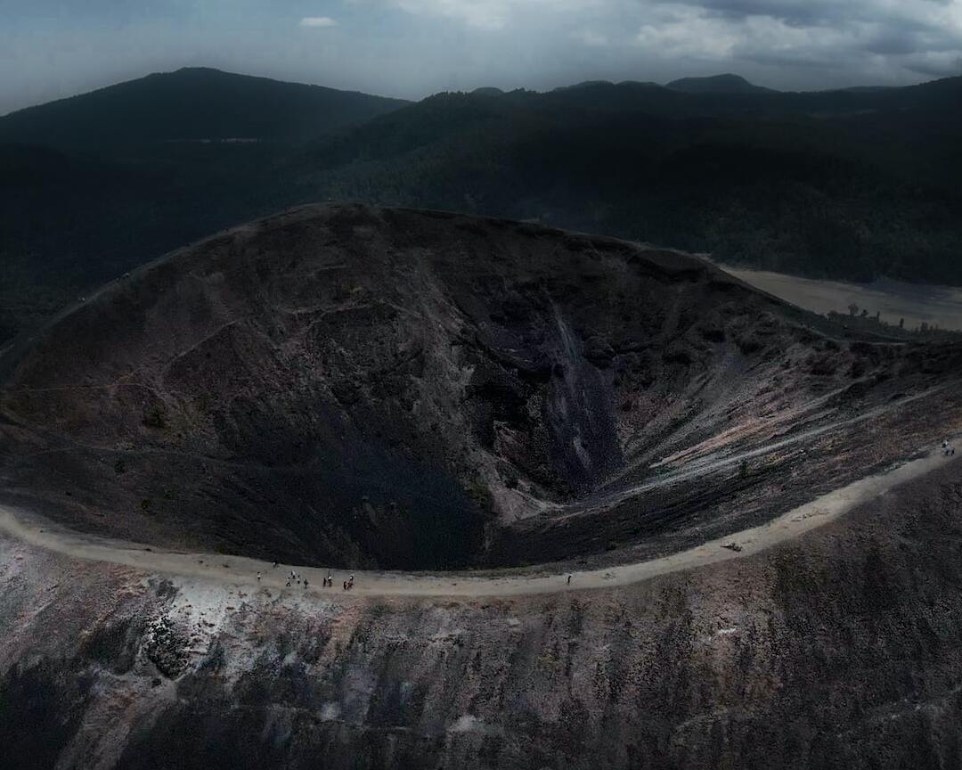
9. Nevado de Colima
Right in the state of Colima, you will find this beautiful hill in the heart of its National Park. Definitely, this will become one of your favorite spots to go hiking in Mexico. Of all the mountains of Mexico that can be climbed, this one has a special advantage: when you reach the top you can closely admire the state’s active volcano. Fun fact: Some prehispanic cultures that were installed in Colima assured that the god of fire reigned in this place.

Important data:
- Elevation: 13,900 ft
- Prominence: 8,923 ft
- Mountain range: Trans-Mexican Volcanic Belt

10. Peña de Bernal
This is one of the biggest monolith boulders in the world that was formed more than 65 million years ago. Actually, it is not correct to think it will be easy to climb it. The place itself is in the state of Queretaro, around a 3h drive from Mexico City.
The little town of Bernal, where the boulder is located, is one of Mexico’s “Magical Towns“. Indeed, there are several places to camp or, if you prefer more comfort, in the town you can find several hotels where one can even find spa facilities to relax after a long exploration.

Important data:
- Elevation: 8,234 ft
- Prominence: 1,148 ft
- Location: San Sebastián Bernal, Querétaro, México
- English translation: Rock of Bernal
- Age of rock: 65 million years
- Parent range: Reserva de la Biosfera Sierra Gorda
🌄 Visit Queretaro and its marvelous surroundings with our tours:
- Queretaro Tour from Mexico City: Explore Impressive Ruins and UNESCO City (12h)
- Mexican wine tour: Taste Queretaro Liquor and Visit a Local Town (Private / 12h)
- San Miguel de Allende Tour: A Marvelous Colonial Town Plus Queretaro (14h)
- Colonial Tour: Travel La Ruta de la Plata Around Picturesque Towns (9 Days)

Honorific Mention: El Paricutin
Have you ever heard about Pompeii? Well, the story of this volcano is pretty similar. Its last eruption was in February 1952 with a column up to 3 kilometers high that lasted only a month. And from then on, the giant Paricutin went back to sleep.
Currently, Angahuan is the closest town to the volcano. From there, you can see between the rocks how the town was destroyed and trapped. Curiously, the only thing that incredibly did not get completely covered by the lava was the church of the Lord of Miracles.
This is a construction from the 18th century and surprisingly the altar and one of its towers remain intact. Today, this altar has flowers and saints of the inhabitants and visitors who have left as an offering after all the changes lived in the area. In fact, the community of Angahuan went from being an unknown place to a tourist area where it has become a tourist attraction. Surprisingly, it is possible to admire the volcano or go hiking around here.
☀️Explore Michoacan wonders by joining our tours:
- Michoacan Tour: Magic Towns, the Youngest Volcano, and More (8 Days)
- UNESCO Sites Mexico: Discover the Amazing Heritage and Nature (9 Days Tour)
- Mexico Monarch Butterfly: Visit Sierra Chincua Sanctuary and a Magic Town (14h)
- Monarch Butterfly Tour Mexico: Visit Amazing Sierra Chincua and Angangueo (12 h)
Frequently Asked Questions
Below are some of the most common questions about hiking in Mexico. Check them out!
How Hard Is It to Climb Mountains in Mexico? 🧗
It depends a lot on which mountain you hike. Each mountain has a different level of difficulty. However, what is extremely necessary for all mountains is to be in excellent physical condition.
How Many Mountains Are in Mexico? ⛰️
There is no exact number of mountains in total in Mexico. This is because Mexico has four main mountain ranges: the Western part of the Mother Range (In Spanish Sierra Madre Occidental), the Eastern Mother Range (In Spanish Sierra Madre Oriental), the South Mother Range (In Spanish Sierra Madre del Sur), and the Neovolcanic Mountain Range. In fact, within each of them, there are different mountains. Some are more famous than others, but all are equally impressive and magical for the best hiking of your life.
What is Mexico City’s Altitude? ❓
Mexico City’s elevation is 7,350 feet high, or 2240 meters. Take into consideration these facts every time you want to do some exercise or extreme sport in this city or near it.
Which is the Highest Mountain to Hike in Mexico? 🌋
Citlaltepetl (Pico de Orizaba) is the highest mountain in Mexico. Please take into consideration hiking there with a professional guide or hiking expert.
Which is the Best Mountain to Hike in Mexico? 🔥
According to TripAdvisor, the top 3 places in Mexico for hiking are Cerro de Tetakawi, San Pedro Martir National Park, and Sierra Tarahumara. (These include landscapes, difficulty, environment, and other factors.)
Which are the Easiest Mountains in Mexico to Hike for Beginners? ✅
There are easier options in Mexico, please consider the one below maybe when you have much more experience in hiking at any mountain. Curiously, according to RedBull.com, on Pico de Orizaba (the highest mountain in Mexico), there are different levels for hiking. Here, beginners can practice or start moderately.
For example, you can hike in parts without snow or danger. A few levels down, you can walk without a problem. However, there are different activities around and options to make your experience unique in this wonderful and impressive place.
Which is the Most Difficult Mountain to Hike in Mexico? 😮
Nevado de Colima and Pico de Orizaba.
Do I Need a Guide for Hiking a Mountain in Mexico? 📖
If it’s your first time, or if you are not experienced in hiking, the best thing is to go with an expert guide or hiker.
What Kind of Equipment Do I Need to Hike a Mountain? 📷
To save yourself and your feet, look for hiking boots that can withstand the rigors of the mountains. Salomon Quest shoes are a great option, for every taste and size.
How Many Hours Does It Take to Hike a Mountain in Mexico? 🕒
It will always depend on the mountain and the tour or experience you want. If you hike some of the highest mountains in Mexico, it may take longer than you expected.
Check out our hiking tours here


